
Guest post by Megan Podolinsky, 2025-2026 Sustainability Leadership Fellow and Ph.D. Candidate in the Department of Ecosystem Science and Sustainability and Graduate Degree Program in Ecology
Picture this: It’s mid-summer in western Kansas. You’re walking through a dry field, the brown, crispy grass crunches underfoot. Long, wide cracks snake across the soil surface, measuring a few inches wide in some areas. Would you believe it if I told you that with a little rain this parched landscape could transform into a vibrant wetland oasis? I’ll admit I was skeptical too, especially during the first summer of my PhD fieldwork sampling wetlands called playas, when I spent the entire season without encountering a single wet playa. I couldn’t help but wonder: What have I gotten myself into? Would I ever witness a playa filled with water?
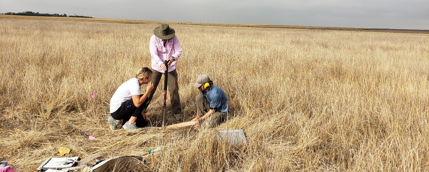
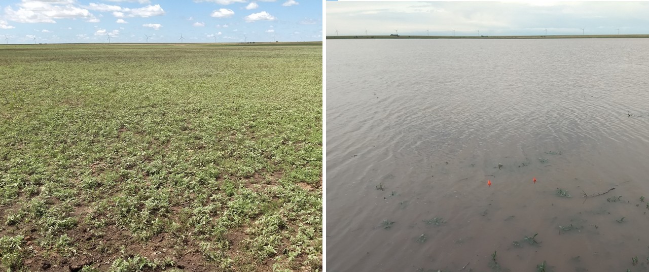
The moment I’d been waiting for finally arrived in the unexpectedly rainy summer of 2023. The field season began much like the last, with the first wetland we visited appearing like the others sampled in 2022 – parched and dry. We planned to sample the wetland over two days but heavy rain and thunderstorms delayed us. When we finally returned a few days later, we couldn’t believe our eyes. The field had transformed into a fully flooded oasis, alive with the chorus of frog calls.
What makes a wetland a wetland?
It may seem strange to call something that is typically so dry a wetland, as the name itself implies it’s simply land that is wet. However, that’s only part of the story because wetlands are far more complex than their name suggests. While the legal definition of what can be regulated as a wetland has changed over time, wetlands are broadly described as areas where water is present all year or for varying periods of time during the year – often enough to support plants adapted to wet conditions and wetland soils. So even when water is present only some of the time, these areas still qualify as wetlands. The playas I study are a prime example of a periodically flooded wetland.
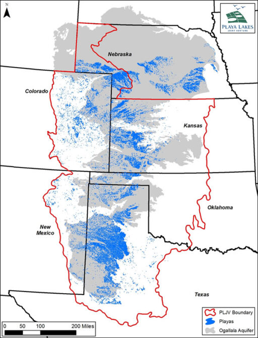
Playas are unique freshwater wetlands – sometimes called mudholes, buffalo wallows, or lagoons – that dot the High Plains region of the United States [1]. There are over 80,000 playas scattered across parts of Nebraska, Colorado, Kansas, New Mexico, Oklahoma, and the Texas Panhandle, with the majority located on private land [1], [2].
These wetlands are masters of change, irregularly fluctuating between wet and dry states, and often flooding for just a few weeks to months. The secret lies in their remarkable clay soils. After it rains, these clay soils become saturated and expand, sealing the wetland basin and allowing the playa to fill with water. As the water evaporates, the clay begins to shrink and crack, unsealing the basin and returning the playa to a dry state. [1]. It’s a mesmerizing cycle that reveals how, even in the driest landscapes, a fleeting oasis can emerge after a storm.
Why do temporary wetlands like playas matter?
Water is scarce in the semi-arid High Plains – on average, the region receives only 10-26 inches (25-65 cm) of precipitation annually, gradually increasing as you move west to east. [3]. This already dry climate is often worsened by abnormally dry conditions and frequent droughts. Rising temperatures, altered timing of precipitation, and increased occurrence of extreme weather events further stresses the region.
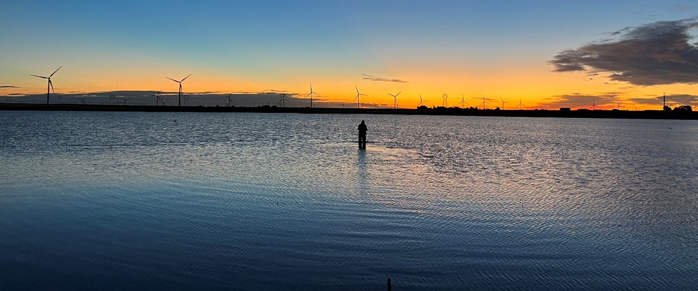
Because the High Plains region is so dry, any sources of surface water – particularly flooded playas – are a precious resource. Although they cover less than 2% of the landscape, playas provide the main source of surface water for the region. They also serve as key recharge points for the underlying Ogallala aquifer, one of the largest freshwater aquifers in the world and a critical water resource for High Plains communities. In addition, playas offer many other benefits to both humans and wildlife including water filtration, erosion control, habitat, and recreational opportunities [1], [2].
The future of playas
Unfortunately, more than 80% of playas have been filled and converted to cropland, reducing their ability to flood and hold water, which can negatively impact many wetland benefits [1], [4]. Because surface water in the dry High Plains region is both limited and increasingly threatened by drought and a warming climate, it is more important than ever to monitor playas. The sheer number of playas, combined with their location on private land, makes on-the-ground sampling difficult and inefficient. It’s even harder to “catch” playas when they are wet since flooding is temporary and unpredictable. To address these challenges, my work in the Landscape Modeling Lab uses satellite imagery combined with field observations to model and predict surface water in playas across the entire High Plains region. This research explores key questions like: What are the main factors driving playa flooding? Can restoration help playas fill and stay wet longer? And do specific management practices increase the frequency and duration of flooding? By improving our understanding of these dynamic wetlands, we can better inform land management decisions aimed at sustaining surface water in a region where every drop counts.
To learn more about playas and ongoing conservation and restoration efforts, visit the Playa Lakes Joint Venture website.
References:
[1] L. M. Smith, Playas of the Great Plains, 1st ed. in Peter T. Flawn series in natural resource management and conservation, no. no. 3. Austin: University of Texas Press, 2003.
[2] L. M. Smith, D. A. Haukos, S. T. McMurry, T. LaGrange, and D. Willis, “Ecosystem services provided by playas in the High Plains: potential influences of USDA conservation programs,” Ecological Applications, vol. 21, no. sp1, pp. S82–S92, Apr. 2011, doi: 10.1890/09-1133.1.
[3] M. Palecki, I. Durre, S. Applequist, A. Arguez, and J. Lawrimore, “U.S. Climate Normals 2020: U.S. Hourly Climate Normals (1991-2020). [30 year normals, annual/seasonal].” NOAA National Centers for Environmental Information, 2021. Accessed: Oct. 04, 2024. [Online]. Available: https://ncei-normals-mapper.rcc-acis.org/
[4] T. E. Dahl, “Wetlands Losses in the United States 1780 ’s TO 1980’s.” U.S. Department of the Interior, Fish and Wildlife Service , Washington. D.C., 1990.