
By Erin Dougherty, 2018-2019 Sustainability Leadership Fellow and Ph.D. Candidate in the Department of Atmospheric Science
Access to clean water and safeguards against droughts and floods are critical to society’s well-being, but too easily taken for granted. We are at a point in U.S. history where we cannot take them for granted anymore.
In 2017, the American Society of Civil Engineers (ACES) gave dams, levees, and inland waterways a D rating, which means these infrastructures are in poor shape and at risk of failure. Dams provide benefits such as drinking water, irrigation, flood control, and hydropower, but 17% across the U.S. have high hazard potential due to growing population, lack of investment, and aging infrastructure.
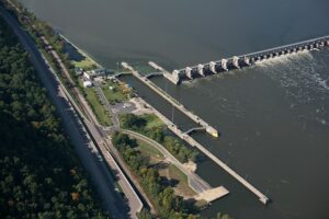
The wear-and-tear on water infrastructure is apparent across the country. Take the Mississippi River–the 2,320 mile long river in the central U.S. that transports 60% of all grains produced in the U.S. The 29 locks and dams in the Upper Mississippi River were built in the 1930s and estimated to last 50 years. Clearly, we are far beyond the lifespan of these systems. Given the high population along the river and frequent flooding, a failing infrastructure would have catastrophic consequences to economy and livelihood.

Such catastrophic consequences have been realized in the Oroville Dam failure in February of 2017. Due to a combination of infrastructure issues and high rainfall amounts from anomalous atmospheric river activity (narrow corridors of high water vapor associated with storms coming off the Pacific), the Oroville Dam’s main and emergency spillways were damaged, leading to evacuations of more than 180,000 people living downstream of the dam.

These examples, and the poor state of the water infrastructure in the U.S., suggests that we need to update aging infrastructure, and do it fast before more catastrophes occur. But we cannot update infrastructure based on past rainfall and streamflow data, because climate change will likely shift rainfall and thus, streamflow patterns (IPCC 2013). We need to replace water infrastructure that is built to withstand effects of climate change. And that’s where the latest research in atmospheric science can help.
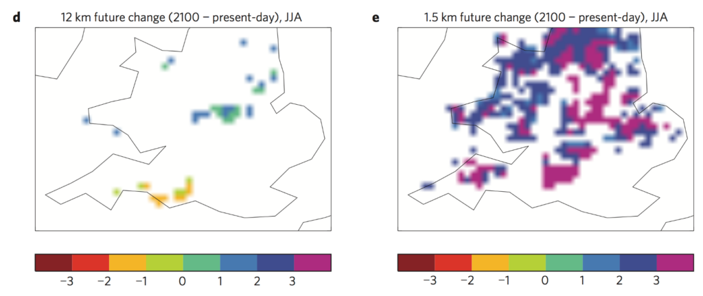
Specifically, we need high-resolution, convection-permitting climate models to help. These are state-of-the-art models in the climate community, where rainfall processes are accurately portrayed and explicitly represented (i.e., convection-permitting), unlike coarse global climate models that have issues in rainfall timing and structure. For example, a study by Kendon et al. (2014) shows the difference between projections of future, heavy summer rainfall in a 12 km model and 1.5 model. Note that most climate models are far coarser than 12 km shown in the example. Yet only the 1.5 km model shows detailed regional increases in summer rainfall over the United Kingdom.
This sort of information by Kendon et al. (2014), and my Ph.D. research examining how rainfall in flood-producing storms might change in a future climate over the U.S., is critical to water-managers. Not only do they need accurate projections of future storm rainfall totals and durations when updating outdated infrastructure according to Vano et al. (2018), but they need it at a high enough resolution to look at future impacts on a detailed, regional basis. Convection-permitting climate models provide that information and should be utilized to update water infrastructure to meet the needs of a society in a future climate, before it is too late.